The KAPtery closed on December 31, 2024. Products can no longer be ordered from these pages. Some products are available for purchase from Ennapurna in France. For questions, replacement parts, special requests, or leftover inventory, use the Contact page above.
Peak yellow
There was a rainy day after my last KAP session followed by a dry day when I was supposed to be getting ready for a weekend rental of a wood splitter. I piled up a lot of logs in the morning, checked the wind forecast, and at 2:30 PM I was driving down a road in Salisbury labelled "Dead End" with the three kites at the low-wind end of my five-kite collection. I had never been on that road or in the alfalfa field I found at the end of it.
 |
| The Picavet on the Saturn V Rig was just 100 feet below the Levitation Delta. That left 900 feet of line to work with. |
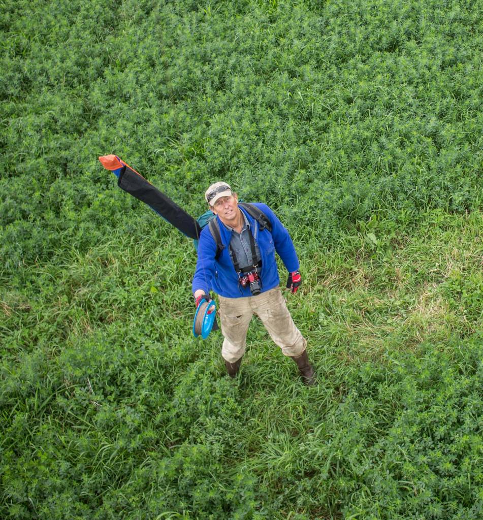 |
| Above: An aerial selfie with alfalfa. |
There was nothing in particular I wanted to photograph from the air, but the trees were doing their brilliant yellow thing, and I had long wanted to explore the mosaic of hayfields and clayplain forest in that flat part of Salisbury.
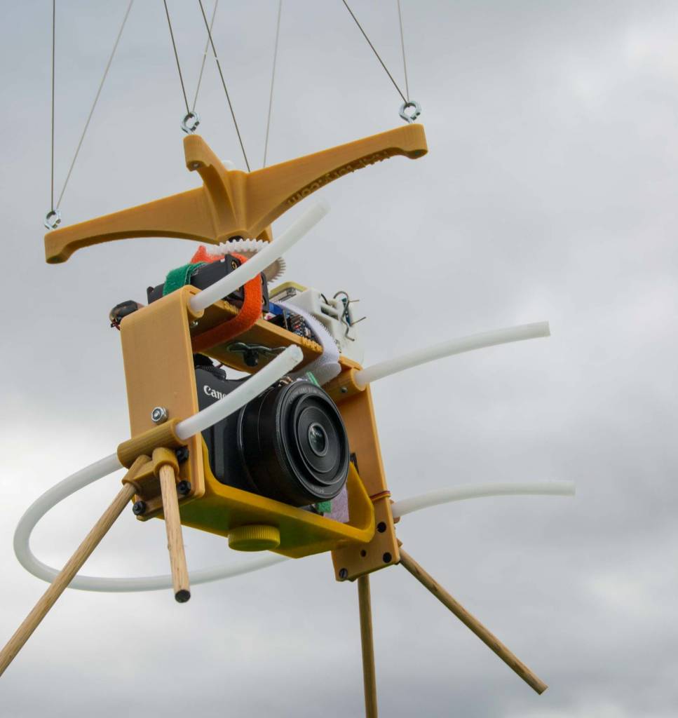 |
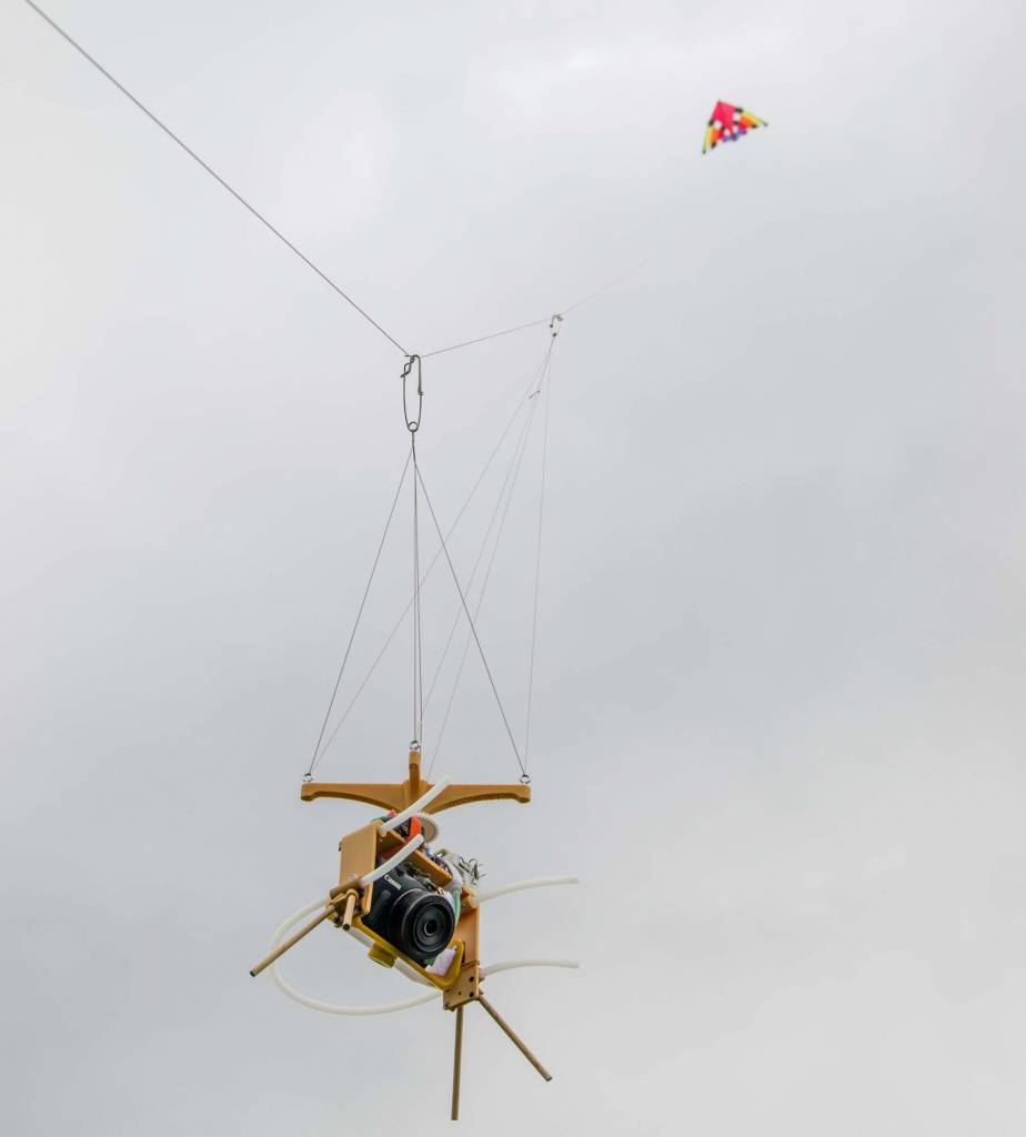
| This Saturn V Rig weighs almost two pounds (0.9 kg). Its features offset that penalty by taking 40 photos every 80 seconds through a prime 37mm lens using a APSC sensor and saving RAW image files. The rig pans and tilts the camera to cover everything but the zenith. It also logs GPS coordinates, temperature, humidity, and barometric pressure every five seconds. |
There was more wind than was forecast, so it was an easy decision to fly the nine-foot Levitation Delta (the windiest kite I had with me). There was a huge cloud overhead, but I assumed it would skid past well before I was able to get the camera very high and then all the golden leaves would be brightly lit for the photos. I made a few quick decisions and set the camera at ISO 200, 1/800 second, Tv (aperture selected for each photo), manual focus at infinity, and camera RAW image files.
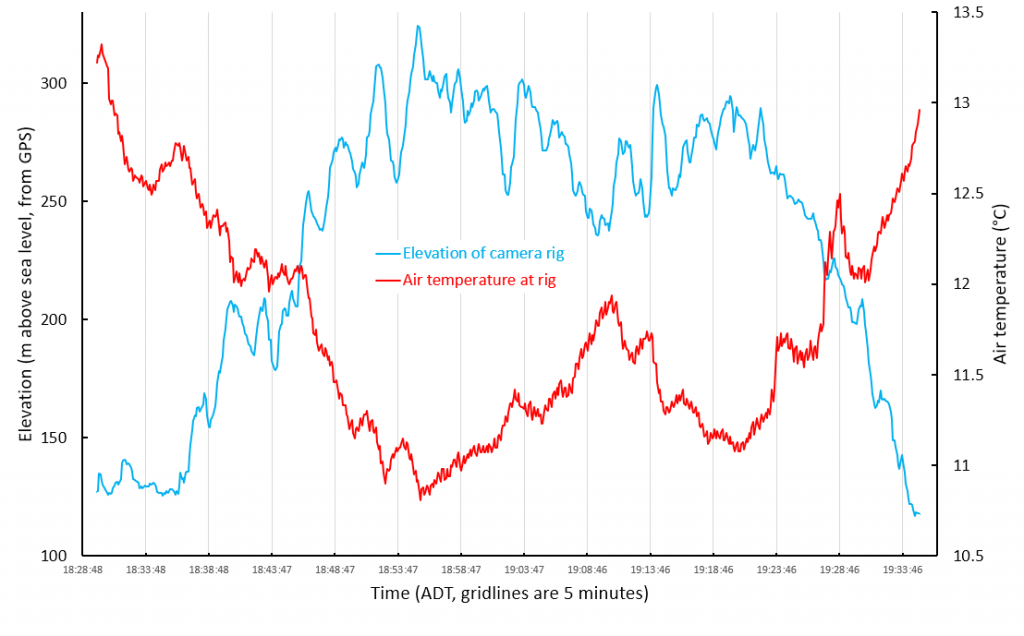 |
| Above: Elevation and air temperature data for the one hour flight courtesy of the SkyPod GPS Logger on the camera rig. It was about two degrees C colder up where the camera was in the middle part of the flight. |
Before bolting from the house, I had modified the SkyShield's Arduino sketch controlling the pan/tilt/shoot sequence. Every two seconds the camera would capture a photo from a different angle. That was as fast as I have ever tried to shoot. I was concerned that the Canon EOS M might not be able to save a 24 MB RAW file to the SD card that fast, and also that the rig would not settle fast enough after each servo move. By taking those risks I made it possible for all 40 photos required to cover the whole scene to be taken in only 80 seconds. That would prevent the rig from flying too far before each sequence completed, and increase the chances that all those photos would stitch together into a single panorama.
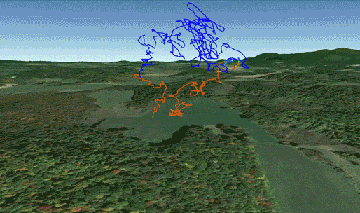 |
| Above: The path followed by the camera rig during the one hour flight. The air temperature was between 12°C and 13.5°C when the rig was below an elevation of 220 meters (orange) and between 10.8° and 12°C above there (blue). Note the shield shaped part of the path where the camera travelled for 30 minutes while I stood in the same place with 1000 feet of kite line out waiting for the sky to clear. |
The skidding cloud settled in for the afternoon and the sun never shone on the trees. After 45 minutes, assuming that every photo already taken was underexposed, I pulled down the kite. I needn't have waited that long because the camera battery had died after 35 minutes. There were 1000 photos on the SD card, and most of them were not as dark as I had expected. The camera RAW files would allow at least one f/stop of brightening, so there was hope. I navigated across the sea of alfalfa to my truck on the forested continent and headed home.
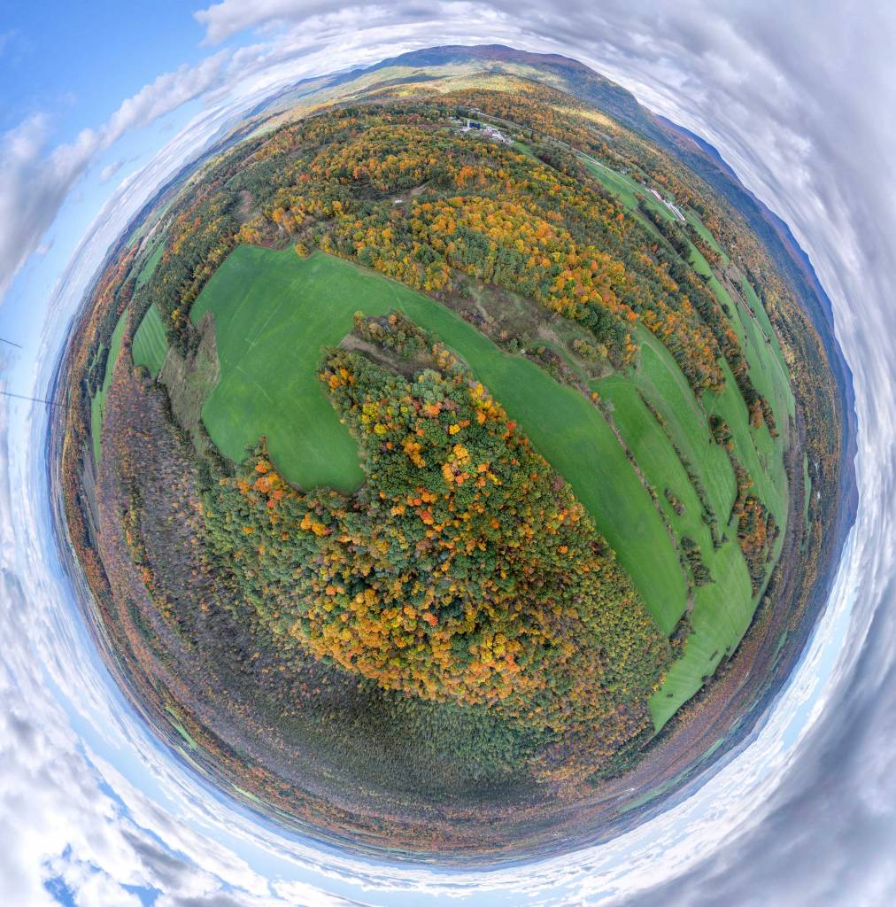 |
| Above: Stereographic projection of a panorama stitched from 40 photos taken in 80 seconds. The Green Mountains are obvious between 12:00 and 4:00 o'clock. The Salisbury Swamp is the grayish area with leafless trees between 3:00 and 9:00 o'clock. |
A few hours later, after arranging another cord of unsplit firewood, I was pleased to see a near perfect stitch of 40 photos into a little planet panorama. It was the first time that photos from the EOS M had stitched with so few artifacts. The new pan/tilt/shoot sequence allowed just enough overlap among photos and captured them fast (the EOS M had no trouble saving the RAW files without missing any shots). In LightRoom, I adjusted the brightness, but after the image above was stitched in Microsoft ICE it was not retouched at all (it could use a little photoshopping, but less than any previous similar stitch).
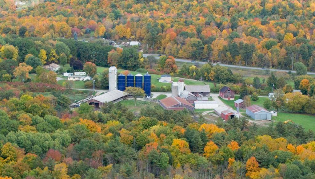 |
| Above: A close crop of one of the photos in the little planet panorama. The farm was 0.8 miles (1.3 km) from the camera. The original photo from the 18 megapixel Canon EOS M has 5185 horizontal pixels and this crop has a little more than a quarter of them (1394, it is a 1.1 megapixel image). When the conditions and camera settings are good, there can be a lot of detail in a full resolution panorama like the one above. |
It is a pleasure to fly the EOS M. Its sensor area is 10 to 13 times larger than a typical PowerShot or GoPro, and the prime lens is ... a real lens. The "little planet" panorama above is a low resolution copy of the original which is equivalent to a 350 megapixel photo (and that does not include all the sky which was cropped out). That KAP rig can make really big panoramas with lots of detail. A few more flights and I should be able to get the most out of it.
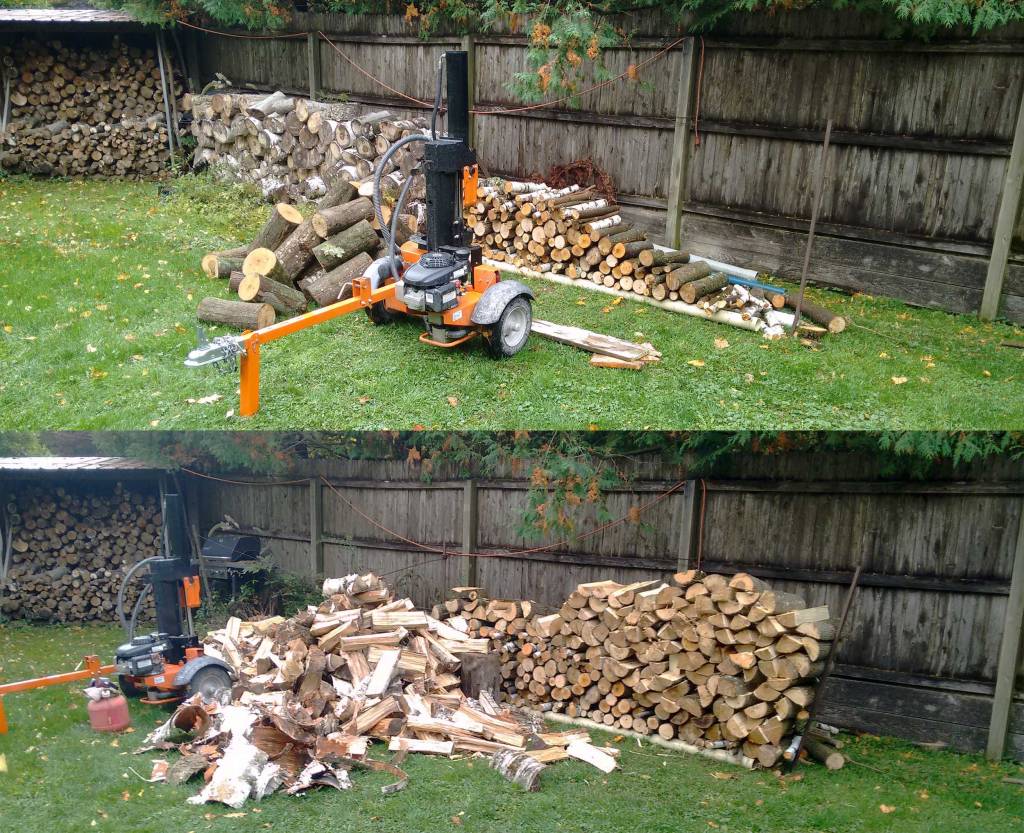 |
| Above: One of the two piles of wood that got a new particle size distribution today. Before (top) and after (bottom). |
